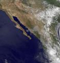
GOES satellite sees Celia's remnants a shadow of her former self
The Geostationary Operational Environmental Satellite, GOES-11 captured a visible image of Celia's remnants on June 29 at 8:45 a.m. EDT revealing it to be a light swirl of clouds in the Eastern Pacific Ocean. GOES-11 was launched by NASA and is now operated by the National Oceanic and Atmospheric Administration (NOAA). NASA's GOES Project at the Goddard Space Flight Center in Greenbelt, Md. created the latest satellite image that showed a very weak Celia.
Celia's remnant low pressure area had maximum sustained winds between 20 and 25 knots (23-28 mph) at 8:45 a.m. EDT this morning. Celia is quasi-stationary and is sitting near 15.5 north latitude and 123.5 west longitude in the open waters of the Eastern Pacific Ocean. Estimated minimum central pressure is 1007 millibars.
Showers were occurring this morning within 60 nautical miles over the eastern semicircle and within 120 nautical miles over the western semicircle. Celia is expected to gradually spin down and open into trough (an extended area of low pressure) by the end of the week. Tropically speaking, Celia is history.
Source: NASA/Goddard Space Flight Center
Articles on the same topic
- Celia and Darby are now both weakening tropical stormsMon, 28 Jun 2010, 17:57:07 UTC
- NASA infrared imagery shows well-defined eye in Category 5 CeliaFri, 25 Jun 2010, 20:46:03 UTC
- GOES-13 captures 2 major hurricanes: Darby trailing CeliaFri, 25 Jun 2010, 20:23:32 UTC
- Celia now in the Major Leagues: a category three hurricaneThu, 24 Jun 2010, 21:22:45 UTC
- NASA satellites see Hurricane Celia strengthen and open an eyeWed, 23 Jun 2010, 19:03:48 UTC
- NASA's TRMM satellite sees Hurricane Celia's moderate rainfallTue, 22 Jun 2010, 16:05:43 UTC
Other sources
- Celia and Darby are now both weakening tropical stormsfrom Science BlogMon, 28 Jun 2010, 18:56:15 UTC
- Celia and Darby are now both weakening tropical stormsfrom PhysorgMon, 28 Jun 2010, 18:21:12 UTC
- NASA infrared imagery shows well-defined eye in Category 5 Celiafrom PhysorgFri, 25 Jun 2010, 23:14:09 UTC
- GOES-13 captures 2 major hurricanes: Darby trailing Celiafrom PhysorgFri, 25 Jun 2010, 22:49:09 UTC
- NASA infrared imagery shows well-defined eye in Category 5 Celiafrom Science BlogFri, 25 Jun 2010, 21:49:22 UTC
- NASA infrared imagery shows well-defined eye in Category 5 Celiafrom Science BlogFri, 25 Jun 2010, 21:49:19 UTC
- GOES-13 captures 2 major hurricanes: Darby trailing Celiafrom Science BlogFri, 25 Jun 2010, 21:49:14 UTC
- GOES-13 captures 2 major hurricanes: Darby trailing Celiafrom Science BlogFri, 25 Jun 2010, 21:49:13 UTC
- Celia now in the Major Leagues: a category three hurricanefrom PhysorgThu, 24 Jun 2010, 21:00:22 UTC
- NASA satellites see Hurricane Celia strengthen and open an eyefrom Science BlogWed, 23 Jun 2010, 21:02:01 UTC
- NASA satellites see Hurricane Celia strengthen and open an eyefrom PhysorgWed, 23 Jun 2010, 20:00:39 UTC
- NASA's TRMM satellite sees Hurricane Celia's moderate rainfallfrom PhysorgTue, 22 Jun 2010, 16:03:23 UTC
