10 years of Soufriere Hills Volcano research published
Related images
(click to enlarge)
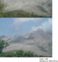
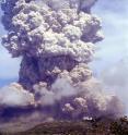
The Soufriere Hills Volcano on Montserrat erupted in 1995, and an international team of researchers has studied this volcano from land and sea since then to understand the workings of andesite volcanos more completely. "To the extent that the Soufriere Hills Volcano is typical of andesitic dome building volcanoes, results from this research can be expected to apply more generally," said Barry Voight, professor emeritus of geosciences, Penn State.
Voight and R. S. J. Sparks, the Channing Wills professor of geology, Bristol University, guest edited and introduced a special issue of Geophysical Research Letters that covers the past ten years of research in the CALIPSO (Caribbean Andesite Lava Island Precision Seismo-geodetic Observatory) and SEA-CALIPSO (Seismic Experiment with Airgun) projects. The U. S. National Science Foundation, U. K. Natural Environmental Research Council, British Geological Survey and Discovery Channel funded these projects.
CALIPSO is a volcano monitoring system installed in late 2002 and early 2003 to monitor magma activity of the volcano. It consists of an array of specialized instruments located in four strategically placed, 650-foot-deep bore holes along with surface and shallow-hole instrumentation. Reports on research from this project look at surface deformation, magma activity, explosive dynamics of the volcano and the magma system. The papers cover four different explosive episodes and volcano mechanics.
SEA-CALIPSO obtained three-dimensional images of the structure of the island of Montserrat and of the volcano's center. It was an active-source seismic experiment to study the Earth's crust beneath the island and the volcano and was under the umbrella of the CALIPSO project.
"This multinational experiment with participation from the U.S., UK, New Zealand, Trinidad and Montserrat generated high resolution images of the island, its volcanic edifices and adjacent crust," said Voight. "This project should advance our understanding of how crust evolves in arc systems, magma is stored and transported and how volcanic processes proceed."
SEA-CALIPSO used seismic tomography, seismic reflection/refraction imaging and offshore seismic profiling to view the deep structure of the volcano. Evaluation of the speed at which seismic waves pass beneath and through the island can provide information on the structure of the crust and the magma chambers beneath the volcano.
The research on both projects was also supported by the Government of Montserrat, Seismic Research Center of the University of West Indies.
Source: Penn State
Other sources
- Experts try to convey danger of Indonesian volcanofrom MSNBC: Science14 years ago
- Ten years of Soufriere Hills Volcano researchfrom Science Daily14 years ago
- 10 years of Soufriere Hills Volcano research publishedfrom Science Blog14 years ago
- Ten years of Soufriere Hills Volcano research publishedfrom Physorg14 years ago


