NASA's GPM observes Tropical Storm Gaston's development
Related images
(click to enlarge)
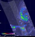
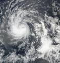
The Global Precipitation Measurement mission or GPM core satellite provided scientists with a look at rainfall rates and cloud heights within Tropical Storm Gaston as it continued to intensify in the Atlantic Ocean. Tropical storm Gaston became the seventh named tropical storm in the Atlantic Ocean after forming southwest of the Cape Verde Islands on Monday evening Aug. 22. Gaston's development followed closely behind Tropical Storm Fiona that formed in the same area southwest of the Cape Verde Islands on Aug. 17. Fiona is now fading quickly in the Atlantic Ocean southwest of Bermuda.
The GPM core observatory satellite had a very good view of forming tropical storm Gaston on Aug. 22 at 2:26 p.m. EDT (1826 UTC). At that time the forming tropical storm was starting to get organized with bands of showers moving around the center of the low's circulation. The GPM satellite had a fairly good view when it flew over newly formed Tropical Storm Gaston on Aug. 23 at 1:56 a.m. EDT (0556 UTC).
Measurements of precipitation with Gaston were derived from GPM's Microwave Imager (GMI) and Dual-Frequency Precipitation Radar (DPR) instruments. The GPM satellite had the best examination of rainfall around the tropical cyclone when it flew over the low's center on Aug. 22. The heaviest precipitation was found by GPM in an area of intense convective storms located well to the southwest of the low. DPR measured rain there falling at a rate of over 141 mm (5.6 inches) per hour.
GPM's Radar (DPR Ku Band) made measurements of the intensity of rainfall and heights of storms near the developing tropical storm. 3-D measurements by DPR found that some storm tops around the developing tropical storm were reaching altitudes above 14.7 km (9.1 miles). GPM is a joint mission between NASA and the Japan Aerospace Exploration Agency.
At 5 a.m. EDT (0900 UTC) on Aug. 24 the center of Tropical Storm Gaston was located 14.9 degrees north latitude and 38.6 degrees west longitude. That's about 975 miles (1,570 km) west of the Cape Verde Islands. The National Hurricane Center said that Gaston is moving toward the west-northwest near 17 mph. A turn toward the northwest is expected later today.
Maximum sustained winds have increased to near 70 mph (110 kph) with higher gusts. Additional strengthening is forecast during the next day or so.
The National Hurricane Center (NHC) discussion noted that microwave imagery showed Gaston's structure has improved since the passage of the GPM core satellite. Gaston has developed a well-defined low-level cloud ring and a mid-level microwave eye. However, Gaston's mid-level center is displaced about 25 nautical miles to the northeast of the low-level center. The University of Wisconsin CIMSS (wind) shear analyses indicated that 10 knots of southwesterly wind shear is affecting Gaston, which could explain the cyclone's tilted structure. The wind shear is expected to remain low enough during the next 24 hours to allow Gaston to strengthen to a hurricane later today.
For updated forecasts on Gaston, visit the National Hurricane Center website: http://www.nhc.noaa.gov.
Source: NASA/Goddard Space Flight Center
Articles on the same topic
- NASA sees examines new tropical storm in infrared lightThu, 25 Aug 2016, 18:04:09 UTC
- Tropical Depression 14W gets absorbed by system 92WThu, 25 Aug 2016, 16:04:25 UTC
- NASA sees a small tropical depression 14WWed, 24 Aug 2016, 17:06:54 UTC
- GPM sees Tropical Depression Kay fading into historyWed, 24 Aug 2016, 17:06:44 UTC
- NASA sees Lionrock strengthen into a typhoonWed, 24 Aug 2016, 16:36:10 UTC
- NASA satellite spots new tropical depression in Northwestern Pacific OceanTue, 23 Aug 2016, 19:07:00 UTC
- NASA's Aqua Satellite sees Tropical Depression Kay sevoid of strengthTue, 23 Aug 2016, 17:04:40 UTC
- NASA sees Tropical Storm Lionrock sonsolidatingTue, 23 Aug 2016, 16:04:52 UTC
- NASA witnesses Atlantic's Tropical Storm Gaston coming togetherTue, 23 Aug 2016, 16:04:42 UTC
- NASA Sees a Fading Fiona in AtlanticTue, 23 Aug 2016, 16:04:33 UTC
- NASA-NOAA's Suomi NPP Satellite sees two Tropical Cyclones near JapanMon, 22 Aug 2016, 17:34:20 UTC
- NASA sees Tropical Storm Fiona weakening from wind shearMon, 22 Aug 2016, 15:03:47 UTC
- NASA sees Tropical Storm Lionrock south of JapanFri, 19 Aug 2016, 18:04:13 UTC
- NASA spies Tropical Storm Mindulle's southern side strengthFri, 19 Aug 2016, 18:04:06 UTC
- NASA's Terra Satellite sees Tropical Storm Dianmu over VietnamFri, 19 Aug 2016, 18:03:54 UTC
- NASA spots strong convection in strengthening Tropical Storm KayFri, 19 Aug 2016, 15:05:16 UTC
- NASA sees wind shear affecting Tropical Storm FionaFri, 19 Aug 2016, 15:05:08 UTC
- NASA sees Tropical Storm 12W over the open Northwestern Pacific OceanThu, 18 Aug 2016, 19:07:13 UTC
- NASA sees Tropical Depression 10W form near GuamThu, 18 Aug 2016, 19:07:05 UTC
- NASA sees formation of Atlantic Ocean's Tropical Storm FionaThu, 18 Aug 2016, 17:03:51 UTC
- NASA sees Tropical Storm Chanthu moving over northern JapanWed, 17 Aug 2016, 17:06:02 UTC
- NASA sees sixth tropical cyclone form in AtlanticWed, 17 Aug 2016, 17:05:52 UTC
- NASA sees wind shear affecting Tropical Storm ChanthuWed, 17 Aug 2016, 17:05:44 UTC
- NASA sees Tropical Storm Chanthu east of JapanWed, 17 Aug 2016, 17:05:34 UTC
Other sources
- NASA sees examines new tropical storm in infrared lightfrom PhysorgThu, 25 Aug 2016, 18:01:39 UTC
- Tropical Depression 14W gets absorbed by system 92Wfrom PhysorgThu, 25 Aug 2016, 16:32:19 UTC
- NASA sees a small tropical depression 14Wfrom PhysorgWed, 24 Aug 2016, 20:01:51 UTC
- GPM sees Tropical Depression Kay fading into historyfrom PhysorgWed, 24 Aug 2016, 20:01:50 UTC
- NASA's GPM observes Tropical Storm Gaston's developmentfrom PhysorgWed, 24 Aug 2016, 19:02:06 UTC
- NASA satellite spots new tropical depression in Northwestern Pacific Oceanfrom PhysorgTue, 23 Aug 2016, 19:03:04 UTC
- NASA's Aqua Satellite sees Tropical Depression Kay sevoid of strengthfrom PhysorgTue, 23 Aug 2016, 17:31:30 UTC
- NASA sees a fading Fiona in Atlanticfrom PhysorgTue, 23 Aug 2016, 16:31:45 UTC
- NASA witnesses Atlantic's Tropical Storm Gaston coming togetherfrom PhysorgTue, 23 Aug 2016, 16:31:41 UTC
- NASA sees Tropical Storm Lionrock sonsolidatingfrom PhysorgTue, 23 Aug 2016, 16:31:40 UTC
- NASA-NOAA's Suomi NPP Satellite sees two Tropical Cyclones near Japanfrom PhysorgMon, 22 Aug 2016, 17:31:15 UTC
- NASA sees Tropical Storm Fiona weakening from wind shearfrom PhysorgMon, 22 Aug 2016, 15:31:15 UTC
- Tropical Storm Fiona weakens to tropical depressionfrom UPIMon, 22 Aug 2016, 14:02:58 UTC
- Tropical Storm Fiona steady as two Atlantic disturbances formfrom UPISun, 21 Aug 2016, 18:01:18 UTC
- NASA sees Tropical Storm Lionrock south of Japanfrom PhysorgFri, 19 Aug 2016, 19:31:22 UTC
- NASA's terra satellite sees Tropical Storm Dianmu over Vietnamfrom PhysorgFri, 19 Aug 2016, 19:31:20 UTC
- NASA spies Tropical Storm Mindulle's southern side strengthfrom PhysorgFri, 19 Aug 2016, 19:31:19 UTC
- NASA sees wind shear affecting Tropical Storm Fionafrom PhysorgFri, 19 Aug 2016, 18:31:39 UTC
- NASA spots strong convection in strengthening Tropical Storm Kayfrom PhysorgFri, 19 Aug 2016, 15:01:28 UTC
- NASA sees Tropical Depression 10W form near Guamfrom PhysorgThu, 18 Aug 2016, 19:31:35 UTC
- NASA sees Tropical Storm 12W over the open Northwestern Pacific Oceanfrom PhysorgThu, 18 Aug 2016, 19:01:50 UTC
- NASA sees formation of Atlantic Ocean's Tropical Storm Fionafrom PhysorgThu, 18 Aug 2016, 17:31:25 UTC
- NASA sees sixth tropical cyclone form in Atlanticfrom PhysorgWed, 17 Aug 2016, 17:31:35 UTC
- NASA sees Tropical Storm Chanthu moving over northern Japanfrom PhysorgWed, 17 Aug 2016, 17:01:40 UTC
- NASA sees wind shear affecting Tropical Storm Chanthufrom PhysorgTue, 16 Aug 2016, 18:31:44 UTC
- NASA sees Tropical Storm Chanthu east of Japanfrom PhysorgMon, 15 Aug 2016, 20:01:54 UTC

