Tropical cyclones are occurring more frequently than before
Related images
(click to enlarge)
Are there more tropical cyclones now than in the past -- or is it just something we believe because we now hear more about them through media coverage and are better able detect them with satellites? New research from the Niels Bohr Institute clearly shows that there is an increasing tendency for cyclones when the climate is warmer, as it has been in recent years. The results are published in the Proceedings of the National Academy of Sciences.
How can you examine the frequency of tropical cyclones throughout history when they have not been systematically registered? Today cyclones are monitored from satellites and you can follow their progress and direction very accurately. But it is only the last approx. 40 years that we have been able to do this. Previously, they used observations from ships and aircraft, but these were not systematic measurements. In order to get a long-term view of the frequency of cyclones, it is necessary to go further back in time and use a uniform reference. Climate scientist Aslak Grinsted of the Centre for Ice and Climate at the Niels Bohr Institute at the University of Copenhagen therefore wanted to find some instruments that have stood and registered measurements continuously over a long period of time.
Correlation between sea levels and cyclones
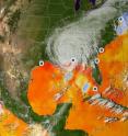
"Tropical cyclones typically form out in the Atlantic Ocean and move towards the U.S. East Coast and the Gulf of Mexico. I found that there were monitoring stations along the Eastern Seaboard of the United States where they had recorded the daily tide levels all the way back to 1923. I have looked at every time there was a rapid change in sea level and I could see that there was a close correlation between sudden changes in sea level and historical accounts of tropical storms," explains Aslak Grinsted.
Aslak Grinsted now had a tool to create statistics on the frequency of cyclones that make landfall -- all the way back to 1923. He could see that there has been an increasing trend in the number of major storm surges since 1923.
Correlation between cyclones and climate
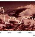
Together with colleagues in China and England, he then looked at the global temperatures over the period to see whether there was a trend for a higher frequency of cyclones in a warmer climate. The global temperature has increased 0.7 degrees C since 1923, but there are variations. For example, there was a warm period in the 1940s but the temperature has really risen since 1980.
"We simply counted how many extreme cyclones with storm surges there were in warm years compared to cold years and we could see that there was a tendency for more cyclones in warmer years," says Aslak Grinsted.
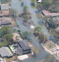
But not all cyclones are equally harmful and those with the highest storm surges tend to cause the most damage. Cyclones with a strength like Katrina, which hit the New Orleans area in 2005 and caused devastating floods and thousands of deaths, make landfall every 10-30 years on average.
"We have calculated that extreme hurricane surges like Katrina are twice as likely in warm years than in cold years. So when the global climate becomes 3 degrees warmer in the future, as predictions show, what happens then?," reflects Aslak Grinsted.
Source: University of Copenhagen
Other sources
- Tropical cyclones are occurring more frequently than before, study showsfrom Science DailyMon, 15 Oct 2012, 20:31:05 UTC
- Study: Tropical cyclones are occurring more frequently than beforefrom PhysorgMon, 15 Oct 2012, 19:01:47 UTC


