Former Ida a huge rainmaker, causing flooding in the Mid-Atlantic
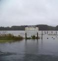
The coastal low, formerly known as Ida, is currently quasi-stationary off the North Carolina coast, adding more rain on top of what it has already brought. The low is creating serious flooding from northeast North Carolina to coastal Virginia. A retired employee of NASA's Wallops Flight Facility provided photographs of flooded roadways in Accomack County, Virginia, and reported trees down and other damages this afternoon.
What's interesting is that Ida is a stronger system now as a coastal low pressure system than when it made landfall in Dauphin Island, Alabama as a tropical storm. At that time, its minimum central pressure was 999 millibars. Today, its minimum central pressure is 992 millibars.
At 4 p.m. ET the center of remnants of Ida was located near latitude 35.2 north and longitude 75.8 west, that's 15 miles west of Hatteras, North Carolina and 65 miles south-southeast of Elizabeth City, North Carolina. The low has maximum sustained winds near 45 mph with higher gusts. Some of those higher gusts have been reported in Hampton, Virginia, and in Accomack County, Virgina.
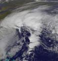
The low is expected to sit where it is off the North Carolina coast through early Friday before slowly moving eastward. The Geostationary Operational Environmental Satellite GOES-12 noticed that the former Ida hasn't moved much since this morning.
GOES-12 is operated by the National Oceanic and Atmospheric Administration. NASA's GOES Project that creates GOES imagery is located at NASA's Goddard Space Flight Center, Greenbelt, Md.
NOAA's Hydrometeorological Prediction Center said this afternoon that "additional heavy rains of 2 to 4 inches are expected through eastern Virginia...eastern and southern Maryland...Delaware...and New Jersey through Friday morning. Isolated totals around 6 inches are possible."
Source: NASA/Goddard Space Flight Center
Articles on the same topic
- Ida now a coastal low assaulting the Mid-AtlanticThu, 12 Nov 2009, 16:57:55 UTC
Other sources
- Former Ida a huge rainmaker, causing flooding in the Mid-Atlanticfrom Science BlogFri, 13 Nov 2009, 15:49:12 UTC
- Former Ida a huge rainmaker, causing flooding in the Mid-Atlanticfrom PhysorgFri, 13 Nov 2009, 14:42:30 UTC
- Ida now a coastal low assaulting the Mid-Atlanticfrom PhysorgThu, 12 Nov 2009, 16:56:15 UTC


