Storm chasers of Utah
Related images
(click to enlarge)
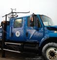
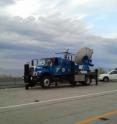
A truck-mounted radar dish often used to chase Midwest tornadoes is getting a workout in Utah this month as University of Utah meteorologists use it to get an unprecedented look inside snow and rain storms over the Salt Lake Valley and the surrounding Wasatch and Oquirrh mountains. "For students who love snow, it's every bit as thrilling as chasing tornadoes," says avid skier and atmospheric sciences Professor Jim Steenburgh. "That's why we call it storm chasing, Utah style."
The Storm Chasing Utah Style Study, SCHUSS -- the term for a straight, downhill ski run -- makes use of a Doppler on Wheels (DOW) radar truck operated by the Center for Severe Weather Research in Boulder, Colo., for the National Science Foundation.
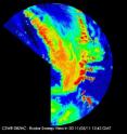
"We have never been able to examine the 'guts' of Wasatch winter storms like we can with the Doppler on Wheels radar that is presently here in Salt Lake City," Steenburgh wrote recently in his Wasatch Weather Weenies blog. "In particular, we can take a meteorological CAT scan of winter storms to see their inner workings."
The Doppler on Wheels truck arrived in Salt Lake City on Oct. 21 and will be here until Nov. 21. During Oct. 22-23, a dozen University of Utah graduate students were trained to drive the truck and use the 6-foot-diameter radar dish transmitter and receiver.
The portable "X-band polarimetric Doppler radar" system was developed originally for studying tornadoes, and Steenburgh says it "measured the strongest wind ever recorded during the Moore, Okla., tornado" in 1999 -- clocked at 318 mph.
The truck's radar emits and receives radio waves horizontally and vertically. This provides more information than radars used by the National Weather Service, which plans to upgrade to the new radars in the next few years.
Steenburgh says the DOW radar can distinguish the size and shape of snowflakes and raindrops in a storm, can collect data on lower-elevation valley locations and can park closer to storms and thus get more detail.
"Despite improvements in weather forecasting over the past few decades, winter storms in Utah remain a challenge to predict," Steenburgh says. "Unlike radars used for weather forecasting, the Doppler on Wheels can be placed anywhere during a storm, enabling us to peer into storms and uncover their secrets. The information we collect can be used to better understand lake-effect, mountain and other Utah storms, and improve computer models used for weather prediction."
When the truck is used to chase tornadoes, "you are constantly driving," he says. "We don't move it around a lot. We let the storm come to us. … But in a long-lived, multiday storm, we would probably move it as the storm characteristics change."
Steenburgh hopes the truck's radar can be used to study eight to 10 storms during its time in Utah, although there haven't been many so far. As of Nov. 10, the radar truck has been deployed for five weather events:
- The radar truck was parked at Lake Point on Interstate-80 and used to look at the structure of a dry, cold front that moved across the Great Salt Lake Oct. 24-25.
- From an observation point on State Route 111 on the west side of the Salt Lake Valley, the radar observed puffy cumulus clouds over the Wasatch Range on Oct. 26.
- On Oct. 30, the radar was deployed to observe breezes blowing southward off the Great Salt Lake and into Rush Valley.
- Parked again on SR-111, the radar truck watched as a cold front with rain and snow moved over the Salt Lake Valley on Nov. 1. The radar captured a burst of heavy snow over Twin Peaks in the Wasatch Range, and got unprecedented images of the "transition zone" where falling snowflakes turn to raindrops. The exact elevation of the transition zone is critical to forecasting if a city like Salt Lake will experience weather of 32 degrees Fahrenheit with heavy snow or 35 degrees with rain.
"The truck is teaching our students with a new kind of radar to better determine where the snow level is and where precipitation is transitioning from rain to snow, which is a big piece of figuring out how much snow is going to fall at any particular location," Steenburgh says.
- A big snowstorm, with some snow enhanced by the Great Salt Lake's "lake effect," was captured by the radar truck on Nov. 4 and 5 as it dumped several inches of snow on Salt Lake City and other Wasatch Front cities. University of Utah students pulled an all-nighter in the truck making measurements of the storm.
"We got an unprecedented data set on the lake effect snow that fell Saturday morning," Steenburgh says. "It was phenomenal."
Steenburgh's enthusiasm for bad weather comes across in his blog. During thje Nov. 1 storm, he told his students: "Just ooh and ahh as you see precipitation bands moving across the mountains." And when the snow started flying Nov. 4, he wrote: "We now have data flowing in from this storm. So psyched."
Source: University of Utah
Other sources
- Storm chasers of Utahfrom Science DailySat, 12 Nov 2011, 20:30:44 UTC
- Storm chasers of Utah: Tornado-hunting radar truck seeks Wasatch snow and rainfrom PhysorgThu, 10 Nov 2011, 15:30:56 UTC
- Storm Chasers of Utah: Radar Truck Seeks Wasatch Snow, Rainfrom Newswise - ScinewsThu, 10 Nov 2011, 14:30:36 UTC


