Danielle now a Category 2 hurricane, NASA satellites working in high gear
Related images
(click to enlarge)
NASA's Aqua, Terra and TRMM satellites are providing data on Hurricane Danielle daily, and forecasters are using that data to help determine Danielle's behavior and movement. At 5 p.m. EDT yesterday, August 23, when Danielle became a hurricane, these NASA satellites fed forecasters data on cloud extent and formation, cloud top temperatures, pressure, sea surface temperatures, rainfall rates within the storm and more factors. By 5 a.m. EDT today, August 24, Danielle had reached Category 2 status on the Saffir-Simpson Scale. That means that it has maximum sustained winds between 96-110 mph (83-95 knots), and has "Extremely dangerous winds will cause extensive damage" if it impacts land areas. For more information about the Saffir-Simpson Hurricane scale, go to: http://www.nhc.noaa.gov/aboutsshws.shtml.
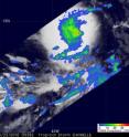
The Tropical Rainfall Measuring Mission satellite (TRMM) has been measuring Danielle's rainfall from space since it developed. On Monday, August 23 at 05:38 UTC (1:38 a.m. EDT) TRMM flew directly over Danielle and measured its rainfall with the TRMM Microwave Imager (TMI) instrument. At that time, there was a large area of moderate to heavy rainfall of over 50 mm/hr (~2 inches) in Danielle around it's center. The rainfall images are at NASA's Goddard Space Flight Center in Greenbelt, Md.
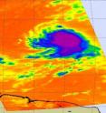
On August 23 at 16:17 UTC (12:17 p.m. EDT) an infrared image of Hurricane Danielle's clouds from the Atmospheric Infrared Sounder (AIRS) instrument aboard NASA's Aqua satellite showed a tightly compact cyclone. The strongest convection and thunderstorms appeared as a large circle in the inside of the storm. The thunderstorms were so high, and powerful that the infrared data measured their temperatures as cold as or colder than -63 Fahrenheit. NASA's Jet Propulsion Laboratory in Pasadena, Calif. creates the images from the AIRS instrument.
Another instrument on NASA's Aqua satellite helped find the center of Danielle early this morning. At 04:34 UTC (12:34 a.m. EDT), Danielle's eye (that developed yesterday) was no longer evident, indicating that it was obscured by clouds. Using the Advanced Microwave Scanning Radiometer - Earth Observing System (AMSR-E) instrument that flies on Aqua, microwave imagery helped locate the center and confirmed that Danielle's center was just left of the previous estimate.
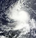
One hour and fifteen minutes after Aqua's AIRS instrument captured an infrared image, the Moderate Resolution Imaging Spectroradiometer (MODIS) instrument on NASA's Terra satellite captured a high-resolution visible image of Danielle. MODIS images are created by the MODIS Rapid Response Team at NASA Goddard. The data that was captured on August 23 at 1:50 p.m. EDT also showed a compact, rounded, tropical storm Danielle. Danielle became a hurricane just over three hours later.
At 5 a.m. EDT on August 24, Danielle became a category 2 hurricane with maximum sustained winds of 100 mph. Hurricane-force winds currently extend 30 miles out from the center, while tropical storm-force winds extend 115 miles from the center.
Danielle is moving west at 20 mph, and was still far away from land areas. Danielle's center was located about 1,110 miles east of the Lesser Antilles near 15.9 North and 44.6 West. A turn toward the west-northwest and then northwest is expected by early Wednesday, according to the National Hurricane Center, Miami, Fla. Danielle's estimated minimum central pressure is 973 millibars.
Global computer models show Danielle remaining in an environment with low vertical wind shear for the next 24 hours over warm water temperatures between 28 and 29 Celsius (82 and 84 FahreLow wind shear and warm waters help power a tropical cyclone (the general name for tropical depressions, tropical storms and hurricanes). Those factors are expected to help Danielle continue to intensify over the next 24 hours, so Danielle could become a major hurricane (Category 3) by Wednesday, August 25.
Source: NASA/Goddard Space Flight Center
Other sources
- Hurricane Danielle Weakens in the Atlanticfrom CBSNews - ScienceThu, 26 Aug 2010, 20:28:38 UTC
- Hurricane Danielle Weakens in the Atlanticfrom CBSNews - ScienceThu, 26 Aug 2010, 11:07:42 UTC
- Hurricane Danielle Weakens in the Atlanticfrom CBSNews - ScienceTue, 24 Aug 2010, 21:42:17 UTC
- Hurricane Danielle Weakens in the Atlanticfrom CBSNews - ScienceTue, 24 Aug 2010, 18:42:14 UTC
- Hurricane Danielle Weakens in the Atlanticfrom CBSNews - ScienceTue, 24 Aug 2010, 17:56:08 UTC
- Danielle now a Category 2 hurricane, NASA satellites working in high gearfrom PhysorgTue, 24 Aug 2010, 14:56:32 UTC


